TRAFFIC ACCIDENT MAP
Perform a deep analysis of traffic safety to get detailed knowledge of high-risk locations and specific accident information.
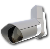
QCAM7
is the ideal ANPR-camera (Recommended)

M³
Compatible with our Macq Mobility Manager

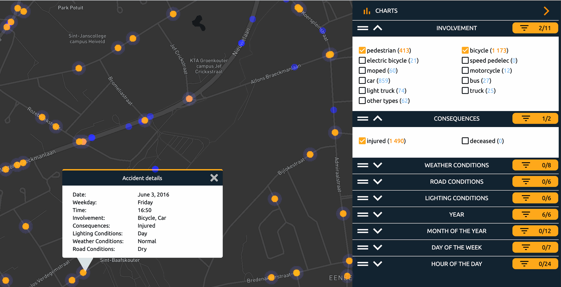
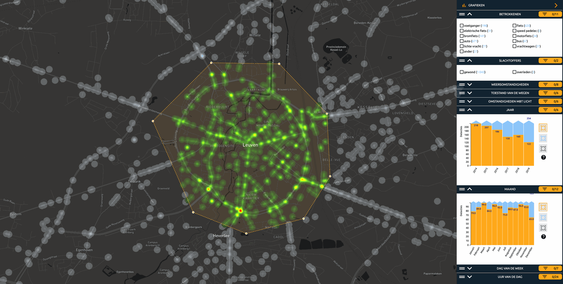
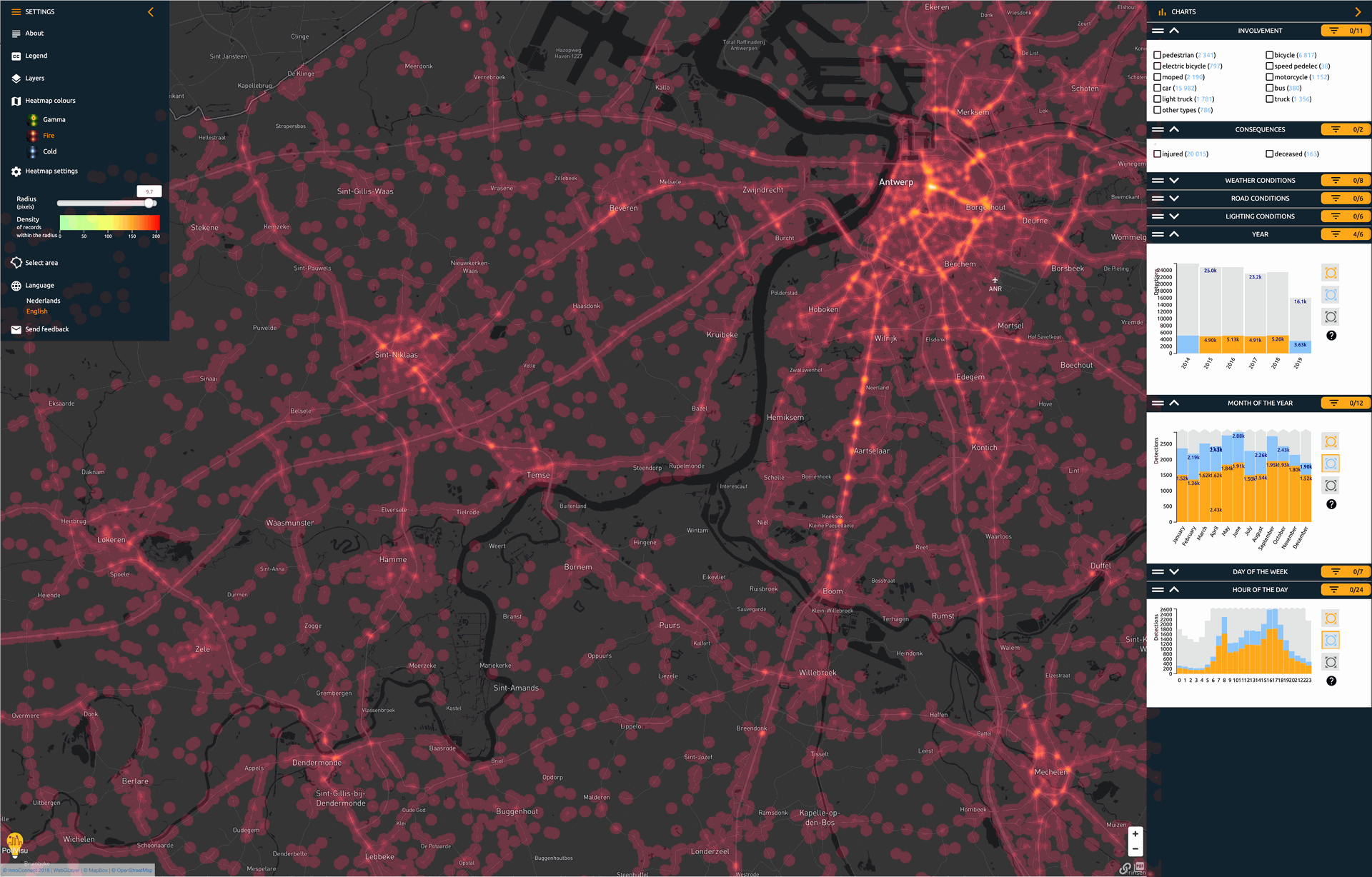
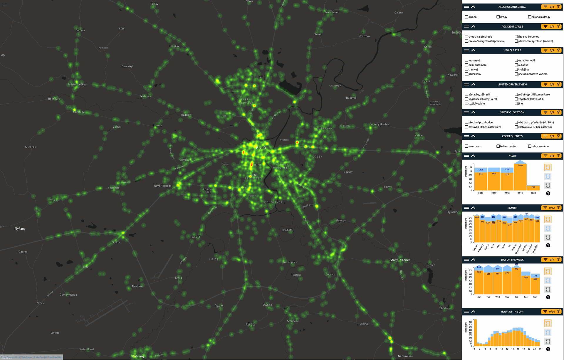
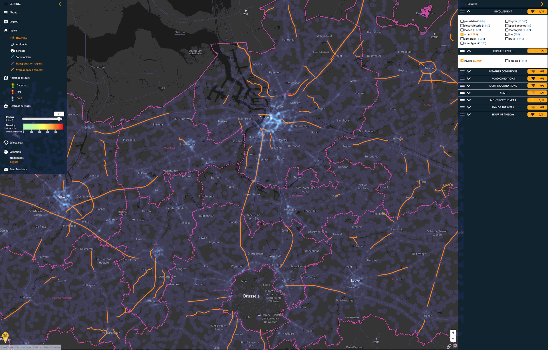
Filter accidents
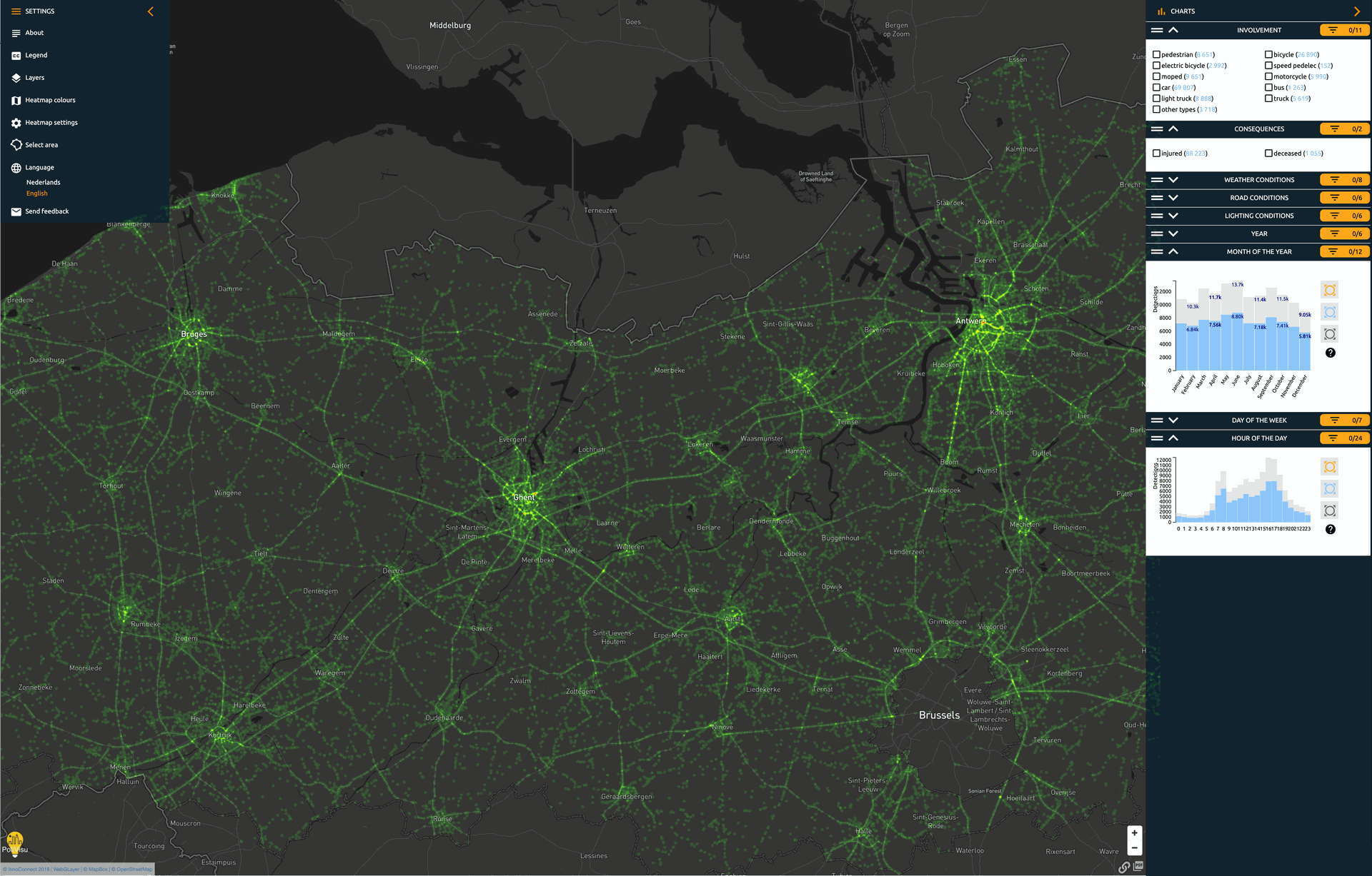
by year, month, day and even hour using the interactive bar charts

Zoom in
on the area of interest via custom (polygon) selection
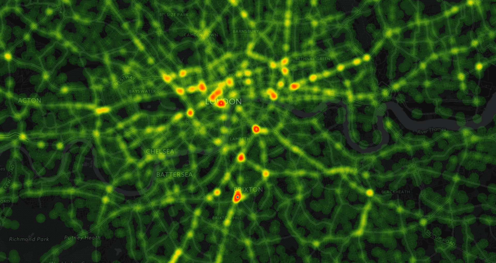
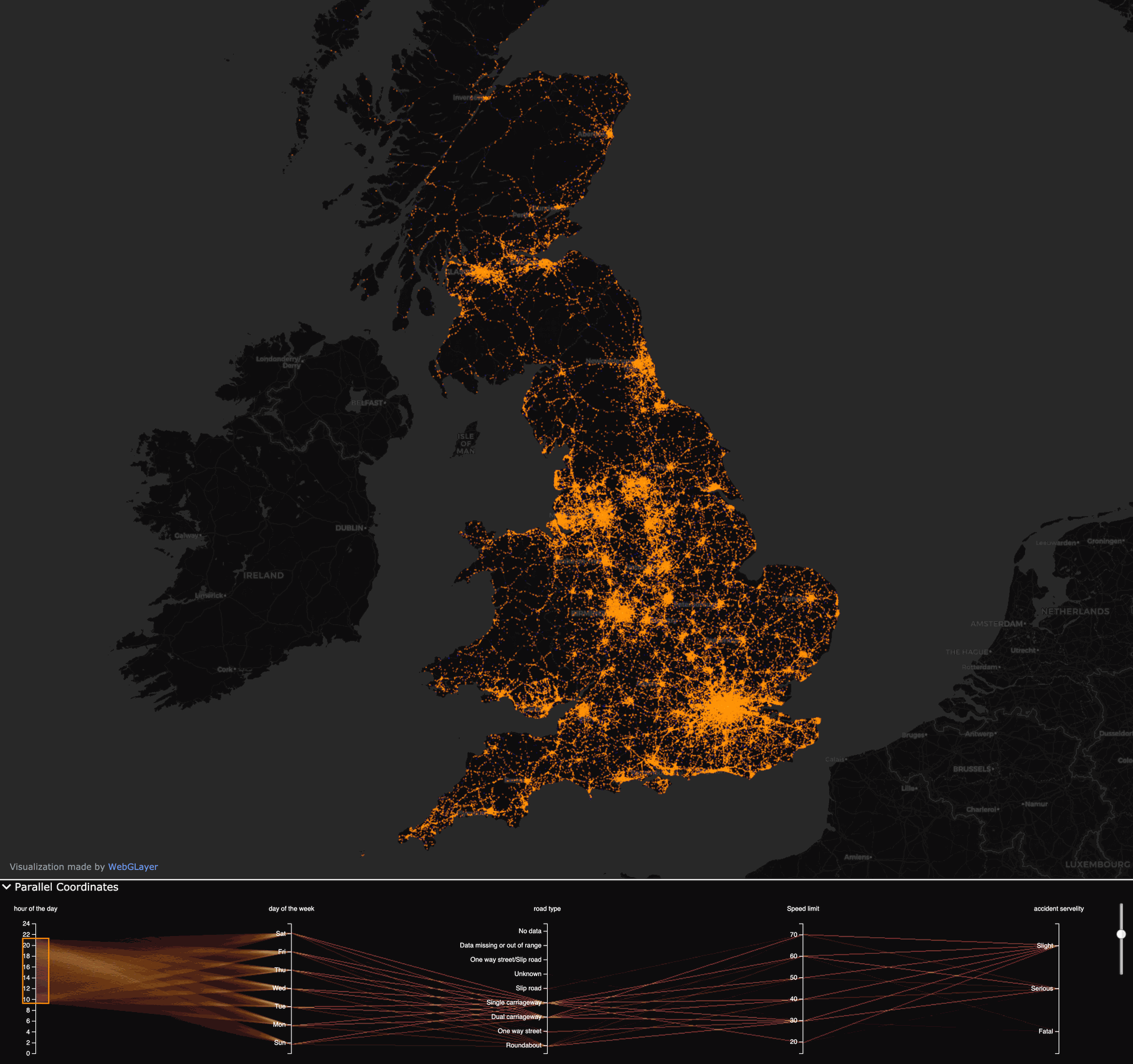
Road safety is a major concern worldwide. With the Traffic Accident Map solution, decision makers at different levels of governance can gain data driven insights to better design, implement and evaluate measures aimed at reducing road accidents. For instance, law enforcement agencies use the tool as a monitoring system to improve daily operations or the quality of Police reports.The module can be configured for any city, police zone, region or country, making use of available data. In Belgium for instance, data is provided by the Federal Police, covers accidents for 2014-2019 and is updated regularly. The accident maps have also been delivered in the Czech Republic (City of Pilsen) and in the UK.
Features
- Filter accidents by year, month, day and even hour using the interactive bar charts
- Get contextual information from data on accident involvement (car, pedestrian, cyclist, electric bicycle, truck etc.), consequences (injured, deceased), weather and road conditions etc.
- Zoom in on the area of interest via custom (polygon) selection
- Add more data layers (schools, communities, regions, average speed control zones) for a deeper contextual analysis
DOWNLOADS
Onepagers
Which camera is most recommended?
Every camera we develop has a different set of features. Find out all of the features and start comparing!
The QCAM7
For the Traffic Accident Map application we advise the use of our QCAM7. Click the button below to get all the information you need.
M³ (Macq Mobility Manager)
All of our products and applications are at their best in combination with our Macq Mobility Manager.
WANT TO KNOW MORE?
LET'S GET IN TOUCH!